diary

I have been on a 50 state, 2500 location, 24000 mile trek across North America. These are the stories along the Way.

a rainy day for saving

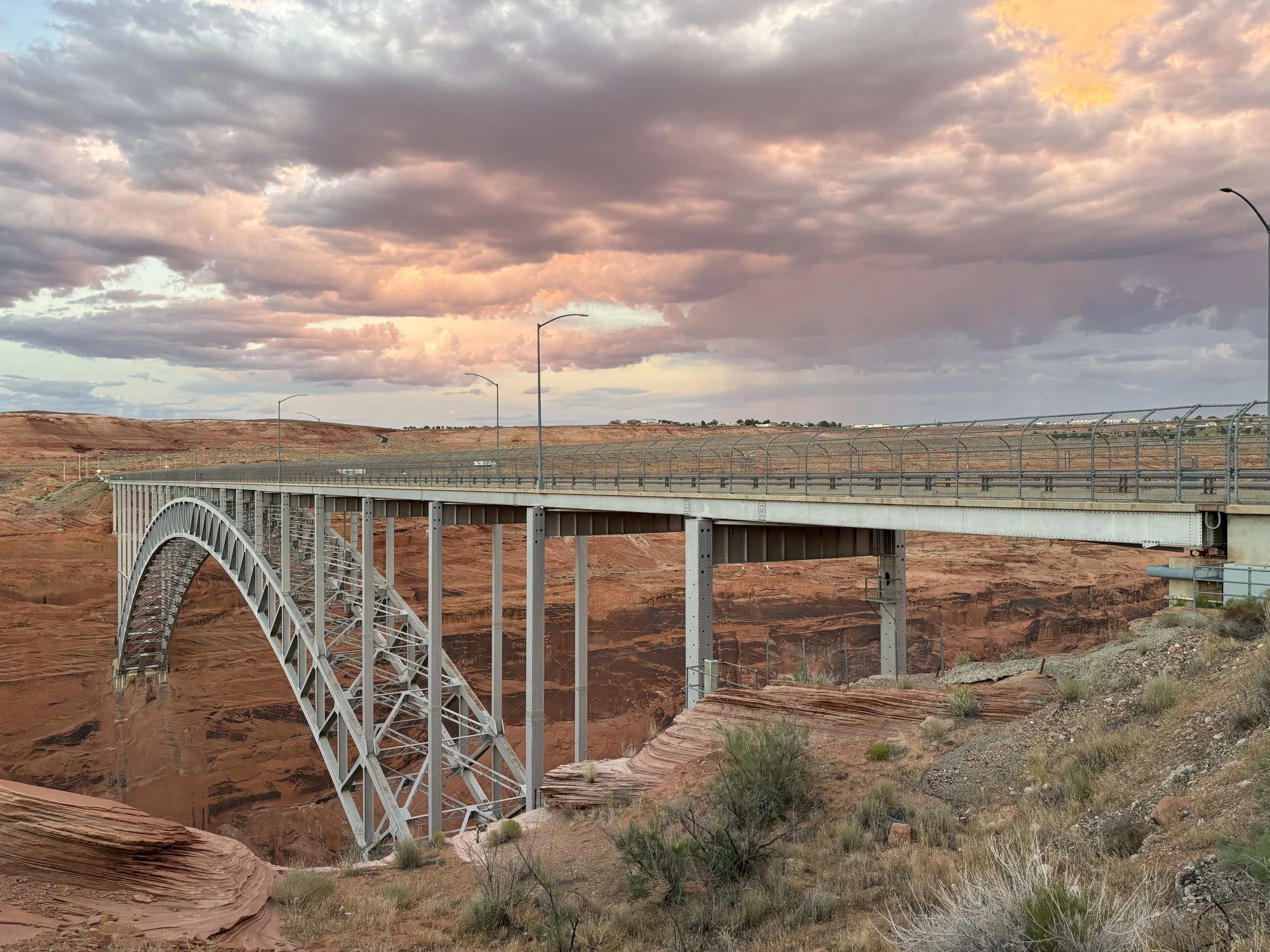
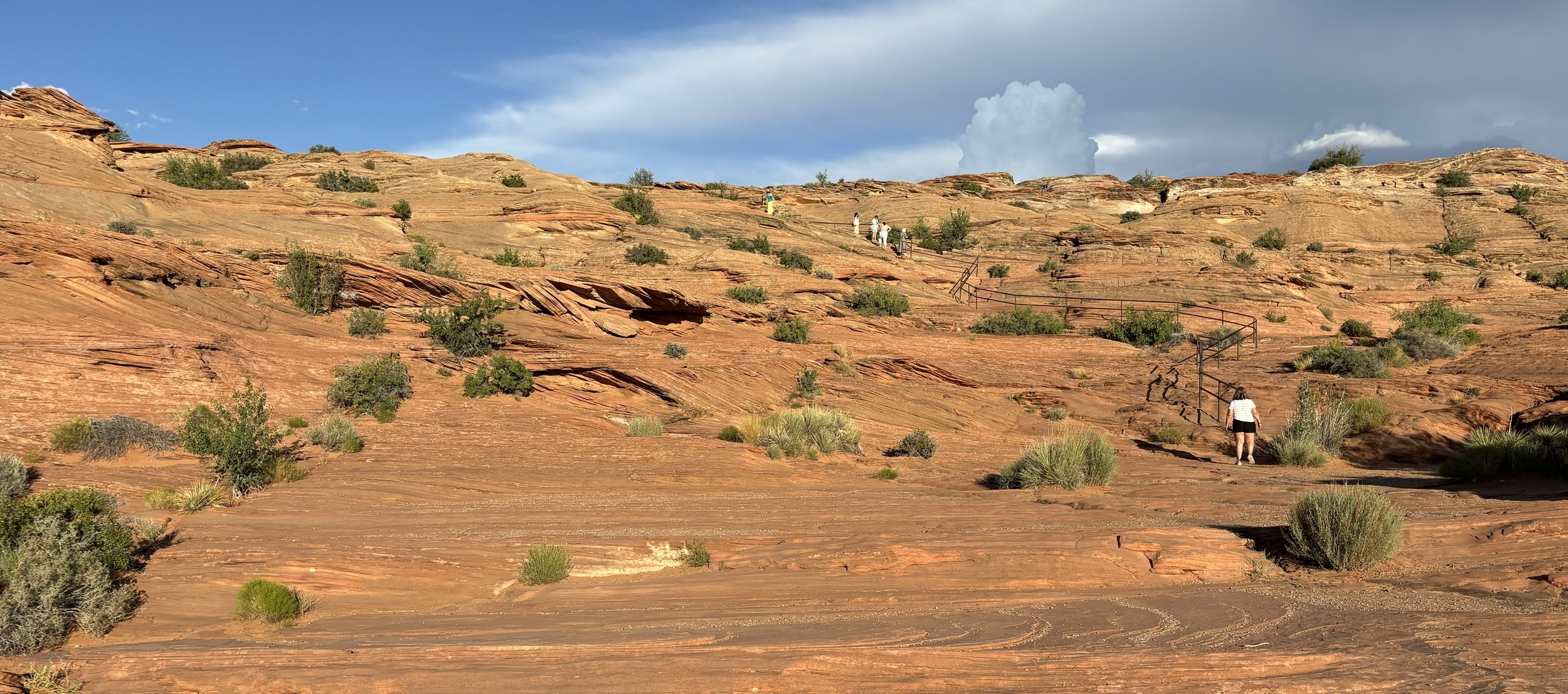
On the east side of the Glen Canyon Bridge, I continued 89 South to the Glen Canyon Dam lookout. There is a zigzagging pathway through smoothly weathered rock to the vista point on the far cliff face.

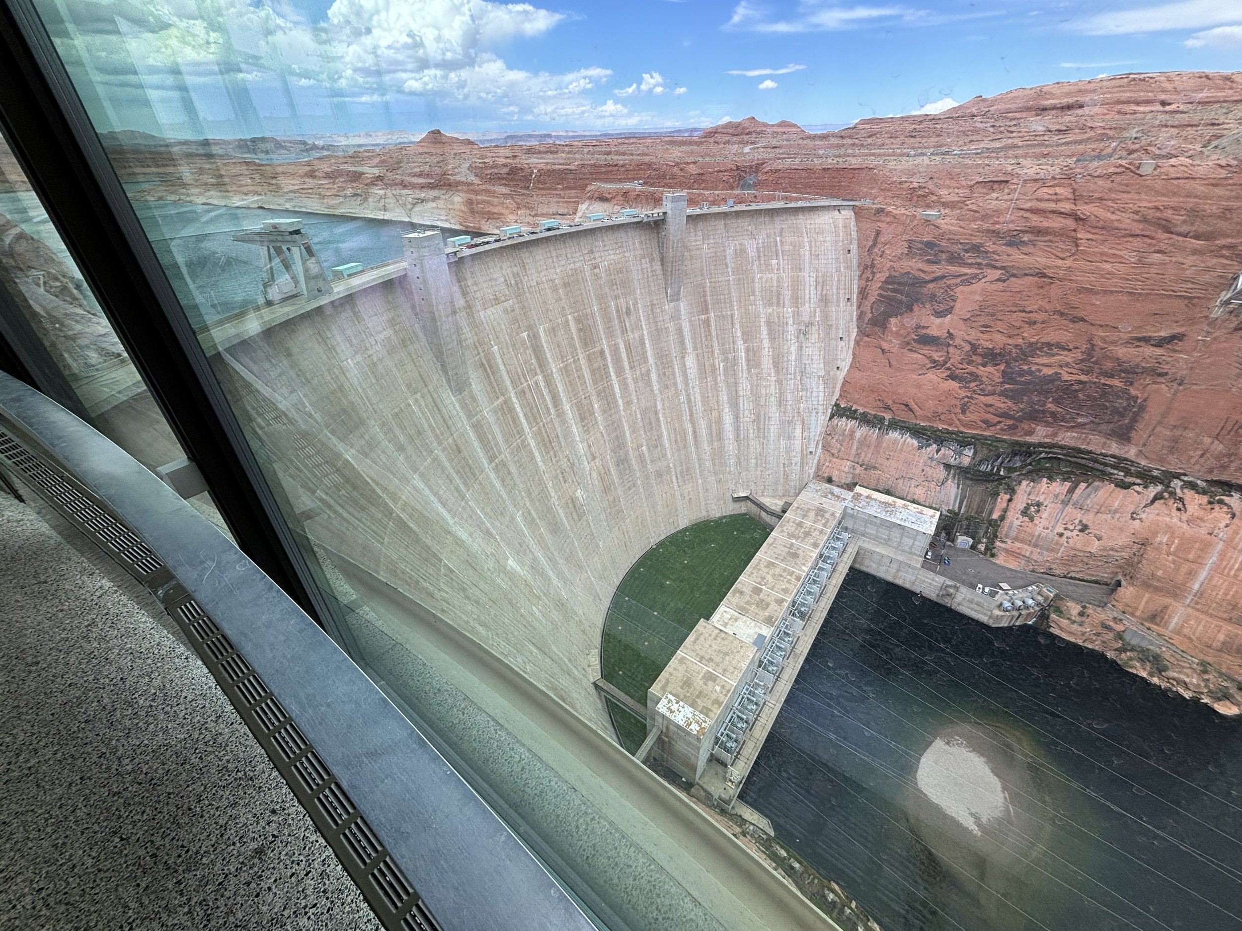
Glen Canyon Dam, rising 710 feet above bedrock within the steep, rust-colored sand-stone walls of Glen Canyon, was constructed to harness the power of the Colorado River in order to provide for the water and power needs of millions of people in the West.

At the bottom of the walkway, I paused to view the water-shaping arch, which is surpassed only 15 feet in height by the Hoover Dam. It’s a bit surreal from a distance, imagining it being built layer by concrete layer.

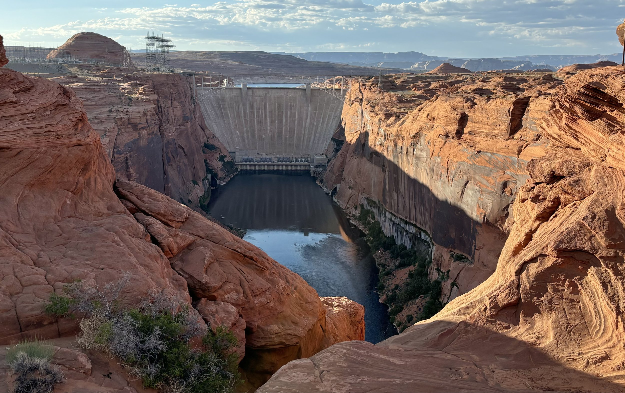
The following afternoon I went to the Carl Hayden Visitor Center, situated 700 feet above the Colorado River next to the dam, to observe from a different point of view.

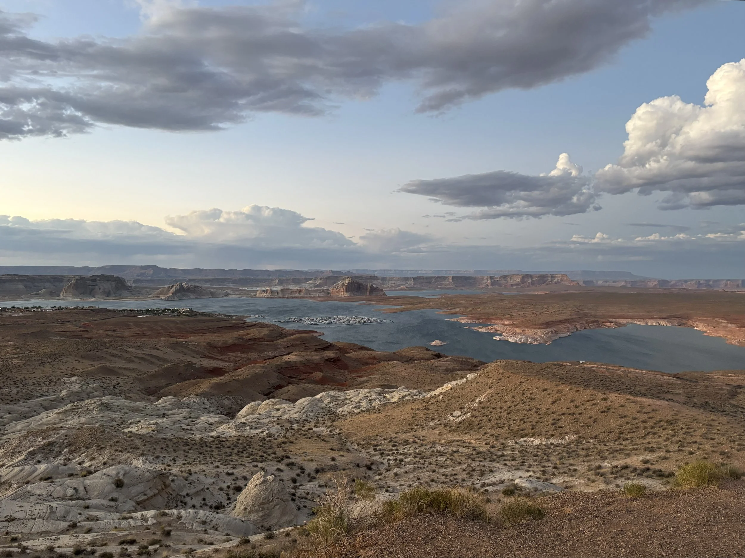
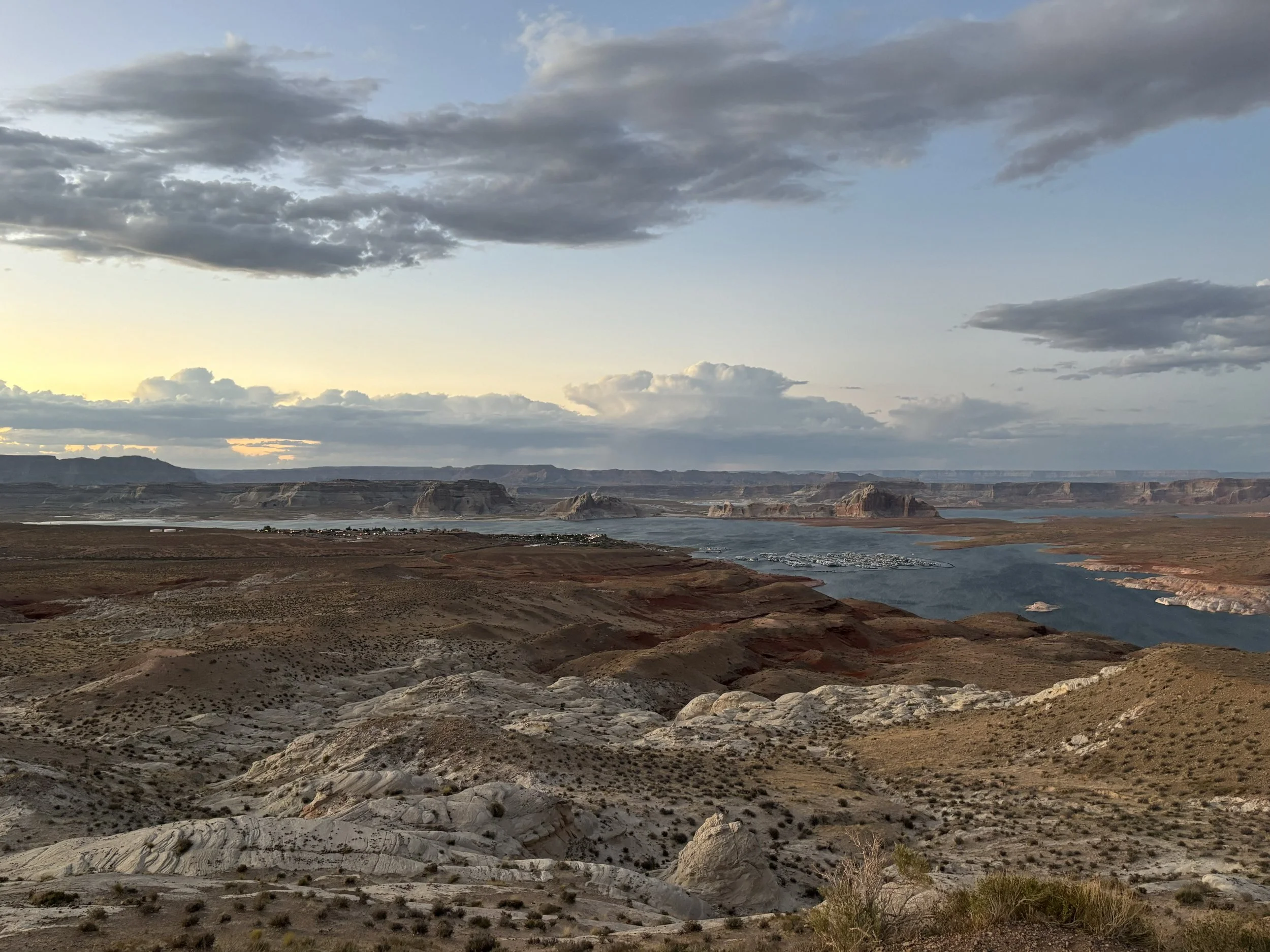
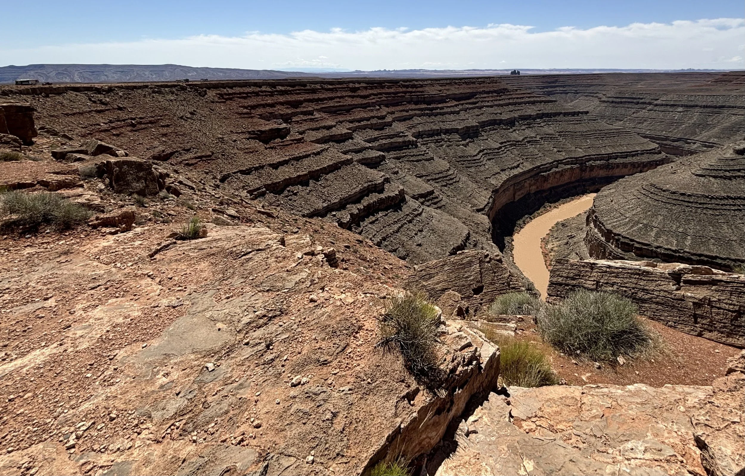
Glen Canyon Dam ensures that when rainfall occurs, it may be stored to meet the needs of millions over a seven state area to carry on without interruption. Being prepared macro-cosmically for resource fluctuation is critical for society to operate. Micro-cosmically it empowers groups and individuals to generate momentum through drought and plenty.

tragnark
fleeting vapor

State Route 98 West over the Kaibito Plateau brings you into Page Arizona. By the time I had arrived it was approaching golden hour, so I turned onto State Route 89 North to Wahweap Overlook, peering hundreds of miles northeast over Wahweap Bay and Antelope Island.

The airscape was a mix of muted lavenders merging with ochres of the soil. Swiveling west showcased an onset of mild oranges peeling through the strata.

Heading back to Page on 89 South, I crossed the Glenn Canyon Dam Bridge, which is tied to impressive architectural history:

At the time of its completion in 1959, the Glen Canyon Dam bridge was the highest arch bridge in the world and the second highest bridge of any type. Crossing the Colorado River about 12 miles (20 km) east of Grand Canyon National Park, the bridge was a necessary component in the construction of the massive Glen Canyon Dam, a concrete gravity arch structure that is just as large as the much more famous Hoover Dam near Las Vegas.

An unusual cloud formation had gathered above the span, having an appearance of fiery blossoms in the sky. The wind was gusty, pushing the phenomenon out of view as mysteriously as it appeared. My favorite slices of time are the fleeting ones. When something exists as vapor, witnessing it is that more special.

tragnark
monuments and moments

After passing through Forrest Gump Point on UT 163 South, I reached Monument Valley.

Tsé Biiʼ Ndzisgaii, (meaning "valley of the rocks") is a region of the Colorado Plateau characterized by a cluster of sandstone buttes, with the largest reaching 1,000 ft above the valley floor. It is considered sacred by the Navajo Nation, the Native American people within whose reservation it lies.

From the visitor center is a clear view of the road melting through the wavy red landscape. Before starting the journey, the Navajo guide shared a map charting the 17 mile circumference.

The first three formations are East Mitten, Merrick (after the silver miner Jack Merrick), and Elephant. The scale is more apparent as the tiny dot of a vehicle drove by the third one.

Turning right instead of staying on the main road leads to a hooked offshoot and the Three Sisters. There was a warning against flying drones in the area. I wondered if it was because one the most pleasant Apple screensavers is a slow motion fly over of Monument Valley, spurring others to attempt the same.

After doubling back onto the loop, it ascends up a snaking road to the entry and exit for the remainder of the counterclockwise navigation around Rain God Mesa. Nestled in a clearing on a bluff nearby is a Navajo horse stable.

As the pathway starts a curved left, Camel is opposite of the horse stable, and The Hub a couple more miles on the right.

Rain God Mesa, whose precipitation run-off feeds into Gypsum Creek, remains to the left and at the center of the wheeled pivot. It’s also the only formation that seems to have an older, previous generation sign intact.

The final overlook, Navajo Code Talker Outpost, ascends to a clearing and a memorial honoring the Code Talkers during World War 2, with an open vista of Spearhead Mesa flanking an array of buttes and mesas in the distance.

After several more miles of driving, the journey concludes where it started, back at the Navajo horse stable. Two puppies from the stable wandered over to me, making for a dramatic composition with Camel.

It was wonderful to be inspired by the land’s monuments and moments, great and small.

tragnark
forrest gump point of view

UT 163 south heading towards Monument Valley and Kayenta is an unwavering arrow through the desert.

When I checked navigation, there was a marker designating a “Forrest Gump Point”. Forrest Gump is one of my favorite movies, and I recalled the cross-coast-country jogging as a memorable vignette. 🏜️🏃🏻‍♂️💨

In conclusion of the 3 year marathon, Forrest reflects on words his mother shared: “You got to put the past behind you, before you can move on.”

Well said.

tragnark
ancient god valley

After descending back down Moki Dugway, I paused at the entryway into the Valley of the Gods, knowing it had little activity due to the road being more rocky and natural. The recent flood would also guarantee that.

A 17-mile dirt and gravel road winds through the valley. It is sandy and bumpy, with steep sections. Because of its isolated nature, people exploring Valley of the Gods need to be self-sufficient and carry emergency supplies. There are no facilities, no gas stations, stores or services. You may or may not see other travelers along the road.

A couple miles in on the periphery was a bed and breakfast! It’s one of the most remote b&bs I’ve seen in the world. I wonder how they get their food and supplies shipped in? Interesting…

After cresting over a hill, the first cluster started populating into view. They were BIG. Since the area was more preserved and free, none of the formations had names listed. So you are left to imagine what each may be, as the Navajo had done centuries ago.

The next 10 miles along the mid-section of the road were rough. I considered turning around a couple of times, as I had resorted to building rock ramps to navigate over steep inclines of mud and sand, but surmised being half-way through, might as well press forward.

Each twist and turn unraveled the mystical quality of the landscape. By this time I was driving for 3 hours and hadn’t seen anyone. It was peacefully and meditatively silent, except for a modest breeze weaving through the underbrush.

About 4 hours in I saw a person in a 4X4 Jeep. We waived to one another. It was the only other I would encounter on the excursion.

The last section of the drive expanded to views of the entire valley and places that had been traveled through from the entryway. A couple additional formations were speckled throughout, making for an afternoon well spent.

When you are far out and remote with no one else around, the state of wonder and awe intensify. Several times I parked and walked around the behemoths, staring up hundreds of feet and thinking about the generations of people and civilizations that have risen and fallen since they existed. In that sense it was like an ancient encounter with ultra-natural forces.

The Valley of the Gods lives up to the name.

tragnark
natural story bridges

After the ascent through Moki Dugway, continuing further north through UT 261 and west along UT 95 brings you to Natural Bridges National Monument.  It is a well-maintained, 9 mile loop with walkways through rock and vegetation to Sipapu, Horse Collar House, Kachina, and Owachomo.

The first stop is Sipapu (place of emergence).  The information board detailed the Permian Layer the Natural Bridges formed from, preceding Arches, Bears Ears, and Monument Valley.

Horsecollar House is at the end of a lightly guard-railed path.  The dwellings are designated by a “south unit”, which contains a round and square kiva structure, and a “north unit”.

The pathway to Kachina starts as an overlook, leading to a trail that provides a ground view up to the formation.  Unfortunately I was unable to hike the full trail, but managed to get a top view of Armstrong and White Canyons.

Owachomo (rock mound) is unique from Sipapu and Kachina as the only bridge which no longer spans the streams that carved it, so it has the appearance of an arch.

The last stop and bonus was a view of Bears Ears.  The Navajo, Ute, and Pueblo people consider the area sacred and include it in their oral traditions.  One Navajo story about the buttes is that of Ataed' diy ini, or Changing-Bear-Maiden.

Naming and anthropomorphizing landforms has a way of imprinting more deeply in our memory.  Empathy level correlates to the number of stories we choose to experience, understand, and pass on through time.

tragnark
moki high way

A guide in the area advised to head north along UT 261, and if I had 4 wheel or all-wheel drive, ascend through the Moki Dugway. It’s a fairy aggressive 10-11% grade, 1200 ft climb with no pavement, no guardrails, and 180 switchbacks. A couple miles out the change of elevation begins revealing itself, with caution signs foreshadowing the next hour of adventure.

At the first vista point the last bits of asphalt melt away into red rock, becoming the many hairpin turns beckoning further and higher travel.

The second vista point reveals the many organic grooves cut into the mountain, and how conformed they are to the cliff face. The constant lefts, rights, and required focus on the sheer drop-off create a hypnotic effect on the drive.

The last set of turns crescendo to the third vista point, showcasing the total elevation gain. The section of the UT 261 coupled to warning signs have reduced to a shoestring line in the desert, with Valley of the Gods in full view. Good day high way.

tragnark
gooseneck turns

After crossing the clay-flooded entryway from the torrential storm the day before, I had finally entered Goosenecks State Park. It was a sweeping view.

….this small park affords impressive views of one of the most striking examples of an entrenched river meander on the North American continent. The San Juan River twists and turns, flowing a distance of over six miles while advancing one and a half miles west on its way to Lake Powell.

Along the perimeter of the canyon were tiny outlines of campers and RVs, parked for rest and a waypoint for hiking. The river’s direction increasingly meandered through the pressure of time. All streams inevitably do this, as the nature of water is to find a way.

From the edge, seeing everything lets you appreciate it beyond the unblemished line from long ago.

tragnark
mexican hat

I had arrived in south east Utah, at the San Juan Inn. It’s off of the 163 where the San Juan River snakes through the desert. I started the day off with a cup of coffee, and noticed that the water line seemed a bit high and muddy. The person working in the kitchen informed me that there was a flash flood the day before, the worst they had seen in months, and to be cautious as sections of roadway had washed out due to the clay soil and sand.

Taking the warning into consideration, the exploration was on its way. The first place I stopped by was the rock formation the area was named after, Mexican Hat Rock.

The Hat Rock measures 60-foot (18 m) wide by 12-foot (3.7 m). The "Hat" has two rock climbing routes ascending it.

Hiking to the underside revealed the unusual balance and weathering pattern that resulted in the flat circular disk balanced on the ziggurat-like foundation supporting it.

Afterwards, I starting heading to Goosenecks State Park. It seemed the advice from the person at the kitchen was accurate. A 50 yard section of the road to the entryway was washed out and caked in a slippery sheet of mud. Giant chunks of asphalt were strewn to the left downhill and downstream.

The soil was still precarious and soft, but the all-wheel drive got me to the other side ok. Sometimes if the destination is intriguing enough, you will take the risk to get there.

tragnark
painted sky

The Four Corners Monument represents the only point in the US shared by four states: Arizona, Colorado, New Mexico, and Arizona. It also represents the boundary between the Navajo and Ute Nations. The atmosphere was active late morning. It seemed the weather from Bisti Wilderness was tracking in the same direction.

As I kept west into southern Utah / northern Arizona along Route 160 and 163, the sky shifted hue and intensity, undulating through every color in the spectrum. The soil permutated from rich browns and farmlands to deep reds and time-sculpted mesas. To compliment the changes in scenery I listened to Vivaldi’s Four Seasons.

By evening I had arrived in Mexican Hat, filled with appreciation for the day’s cinescopic experience.

tragnark
ship rock

Driving west through the Four Corners region on Route 64, I scanned south and noticed something otherworldly. It interrupted the horizon line, piercing upward like a cluster of spires. While not architected, it is a Ship Rock, having spiritual significance to the Navajo tribes of the land.

The Ship Rock landform, located in northwestern New Mexico, is the remnant of an explosive volcanic eruption that occurred around 30 million years ago. The main part of the landform is 600 meters high, and 500 meters in diameter. Ship Rock, known as Tse Bitai, or "the winged rock" in Navajo, is a volcanic neck, or the central feeder pipe of larger volcanic landform which has since eroded away. The neck is composed of fractured volcanic rock, or breccia, crosscut by many thin veins of lava.

Here’s another photo a few miles closer. Things that are different have a way of drawing attention at a distance.

tragnark
bisti de-na-zin oasis

This was a day of hiking the Bisti De-Na-Zin Wilderness Area. As soon as you pull off the main road it becomes a one lane, unpaved dirt path. Several miles into the desert unique rock formations started appearing everywhere.

Time and natural elements have etched a fantasy world of strange rock formations made of interbedded sandstone, shale, mudstone, coal, and silt. The weathering of the sandstone forms hoodoos - weathered rock in the form of pinnacles, spires, cap rocks, and other unusual forms. Fossils occur in this sedimentary landform. Translated from the Navajo language, Bisti (Bis-tie) means "a large area of shale hills." De-Na-Zin (Deh-nah-zin) takes its name from the Navajo words for "cranes."

At the end of the roadway, I arrived at the entrance to the exploration area. The caution on the gate and barbed wire fencing was clear, as were the additional road signs warning of impassability during floods. I pulled the chain off the gate lock and proceeded on foot.

The rock formations took on new silhouettes, casting long shadows onto the packed sand and dried flood plains. The dark peppering of the coal mixed in with the lighter sediment created otherworldly and additional lowlights as the dry air, unencumbered by trees, pushed through the landscape. I looked south of my location over the cracked riverbed and could see storm clouds forming on the horizon.

The last section I hiked through saw the broken rock formations morph to shaded and topped, wind carved Hoodoos. I peeked around several of them wondering if I’d encounter a Tuskin Raider or Jawa Sand Crawler. The growing thunderheads and lighting flares in the distance told me that it was time to head back.

As I was packing up to go, I noticed two people with a canopy and asked if they needed help securing it to the ground. While doing so, I started talking to them about adventures in the wilderness, and they invited me to have a drink with them in the pull-out bar installed in the back of the 4Runner. We set up 3 lawn chairs, swapping stories while the storm rolled in. That was ok, though. Weather patterns are temporary. The company of others and shelter make it an enjoyable experience.

tragnark